MappingForRights
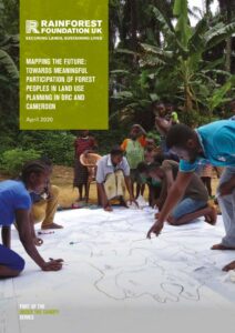
Mapping the Future: Towards Meaningful Participation of Forest Peoples in Land-use Planning in DRC and Cameroon
This RFUK report charts way to better inclusion of forest communities in Congo Basin land use planning processes.

Community-based Land-use Planning
In 2018, RFUK launched a new participatory mapping and land-use planning project in Maniema province, in the Democratic Republic of Congo (DRC). It aims to develop a community-driven model that will inform land-use planning at the local and national level, serving as an example for a more sustainable and equitable approach to land management.

Participatory Mapping and Community Forests in the Democratic Republic of Congo
If well implemented, new community forest legislation in the DRC offers an unprecedented opportunity for communities to obtain legal rights to forests they have inhabited for generations and to improve their livelihoods. However, for community forests to deliver equitable and sustainable outcomes there is a need to ensure that they are developed by the communities themselves, … Read more
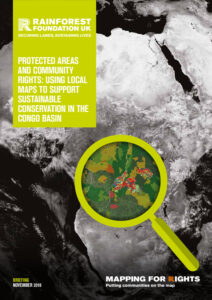
Protected Areas and Community Rights: Using Local Maps to Support Sustainable Conservation in the Congo Basin
The best conservation projects start with people. Yet protected areas in the Congo Basin continue to be established and managed with poor consideration for local communities’ land and resource rights, fostering conflicts and human rights abuses. A lot of these toxic situations could be avoided if thorough participatory community mapping data, such as collected through MappingForRights, … Read more
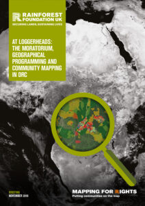
At Loggerheads: The Moratorium, Geographical Programming And Community Mapping In DRC
Of the three legal conditions attached to lifting DR Congo’s moratorium on new logging concessions, arguably only the third condition (on “geographic programming of future allocations”) remains to be fulfilled. Drawing on mapping data collected through MappingForRights and other sources, this briefing shows that any process which does not sufficiently take into account communities and … Read more

REDD and Rights in DRC: How Participatory Maps Can Inform the Mai-Ndombe Integrated REDD Programme
Forest tenure and resource mapping by local communities in Mai Ndombe is providing a highly detailed and comprehensive picture of customary claims and usages that are likely to extend across the entire province. The results, which authorised users can view on MappingForRights, have major implications for DRC’s flagship jurisdictional REDD+ programme, especially in terms of … Read more
How community mapping can inform better policy decisions in the Congo Basin
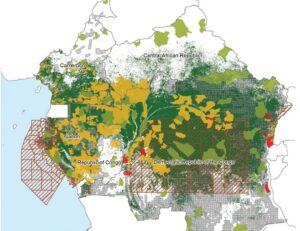
Map showing overlap between customary rights and formal land allocations in Mai Ndombe province, DRC | Source: MappingForRights, WRI How do you decide the location and boundaries for a new nature reserve? How will new palm oil plantations impact nearby forest dwellers? How can local forest communities best secure their land and improve their livelihoods … Read more

Mapping For Rights: Putting Rainforest Communities on the Map
Since its launch in 2011, MappingForRights has supported more than a thousand communities to map and share highly detailed geographical information about their lands and resources so that decisions on forests do not neglect those who depend on them most. In this introductory briefing, we address the root causes land-based conflict in Central African forests, … Read more

International workshops show how community mapping can support sustainable forest management
In November and December 2017, the Rainforest Foundation UK (RFUK) brought together participants from three Central African countries to train them on how to use innovative mapping tools in order to support community forestry. The workshops were attended by participants from Gabon, the Republic of Congo and the Central African Republic (CAR). The workshop series … Read more

Inongo Sector, DRC: An Atlas of Traditional Community Life
This community ‘atlas’ provides information on the realities and traditional livelihoods of the communities of Inongo sector, in the Inongo territory, Mai-Ndombe province, in the Democratic Republic of Congo.